Bolton to Toronto down the Humber river in a kayak
By Andrew Smith (trip with Bill
Hilton)
25 June 2011
Though I've been on a couple of longish trips in a canoe (alone in
Algonquin and with Bill in Temagami) I have never sat in a Kayak.
But the summer was running out and I wanted to do something
interesting, so why not a day-long trip down a river in a Kayak?
There are three candidate rivers:
- the Don River (where the Don Valley Parkway is),
- the Credit River (if you're a rider in the GTA - you have
heard of the Forks of the Credit), and
- the Humber River, also in the west
I've been browsing the net, trying to find an account of a similar
trip, or at least some pointers about the conditions on either of
those rivers, but surprisingly I found next to nothing. That was
really strange. I know I've heard of clubs that organize boating
events down the Don but I found no info that way, and there's the
Credit Valley conservation authority who have some pointers on their
website but not nearly enough to plan a trip (unless you want to
plan not to go).
There aren't any maps either. A good map would be very helpful. I
expected all the rivers to be broken in places (with dams or grated
bridges) and go through private property (like everything else in
the GTA), but there was no way to confirm there were such
obstructions and how many. There's the good old MapArt that's
useless for rivers and there's Google Maps, but even with the
satellite photos it was very difficult to see the river (it's too
small and the shadows from the trees make it very hard to see.
I did find one good piece of news on the CVC website - apparently
the rivers themselves are owned by the crown exclusively. There was
a caveat there though: the riverbeds are not owned by the crown and
any constructions over the river (like dams) are likely also private
property. But I figured there's enough legal wiggle-room there for
me to pass along quickly, I was not planning to camp on the side of
the river nor cause any problems.
The only place I found that would rent kayaks by the day was MEC in
downtown Toronto. I like the shop, and since the plan was to go all
the way to Toronto - it didn't much matter whether we rent the boats
at the beginning of our trip or in the end - we'd have to transport
them all the way once regardless. Renting a kayak was I think 35$
per day, which I thought was quite reasonable.
I asked Bill if he was also interested, he said yes, and we made our
plan. We'd both drive downtown separately friday evening, have the
rented kayaks mounted on our cars, and both come back to my place in
Maple for the night. Then first thing saturday morning we'd get off
to.. Bolton. We decided on the Humber. I don't quite remember why, I
think the fact that my girlfriend works and has family there had
something to do with it, otherwise it was a pretty random decision.
When I went canoeing in Algonquin I found that as-the-bird-flies
distances traveled on rivers take much (at least 2 to 3 times)
longer to traverse than the same distances on lakes. In Algonquin
I explained that by the countless little twists and the multitude
of beaver dams on the rivers. Here I didn't know what to expect -
on the one hand it was likely to be the same, but on the other
hand it looked like only big loops and few small twisties, and
somehow I figured there wouldn't be a lot of beavers in a
metropolitan river. Plus I've never done anything in a kayak and I
didn't know how fast I'd be able to go in it. I had to guess where
to start so we'd end up hopefully in lake Ontario by the end of
the day.
Bolton was obviously ambitious from the start. The linear
distance to the lake divided by the unlikely 6km/h was I think
over 10 hours, and that didn't count getting around obstructions,
resting, and eating. But that was ok, because:
- better too hard than too easy, easy was not the point of this
trip,
- if we didn't make it all the way down and had to go home early
- no big deal,
- we could potentially sleep overnight on the way, in a park if
we had to, and
- depending on conditions we could even try to keep going
through the night
Given all that - Bolton to lake Ontario was unlikely to happen in
one day, but might as well start there, so we did.
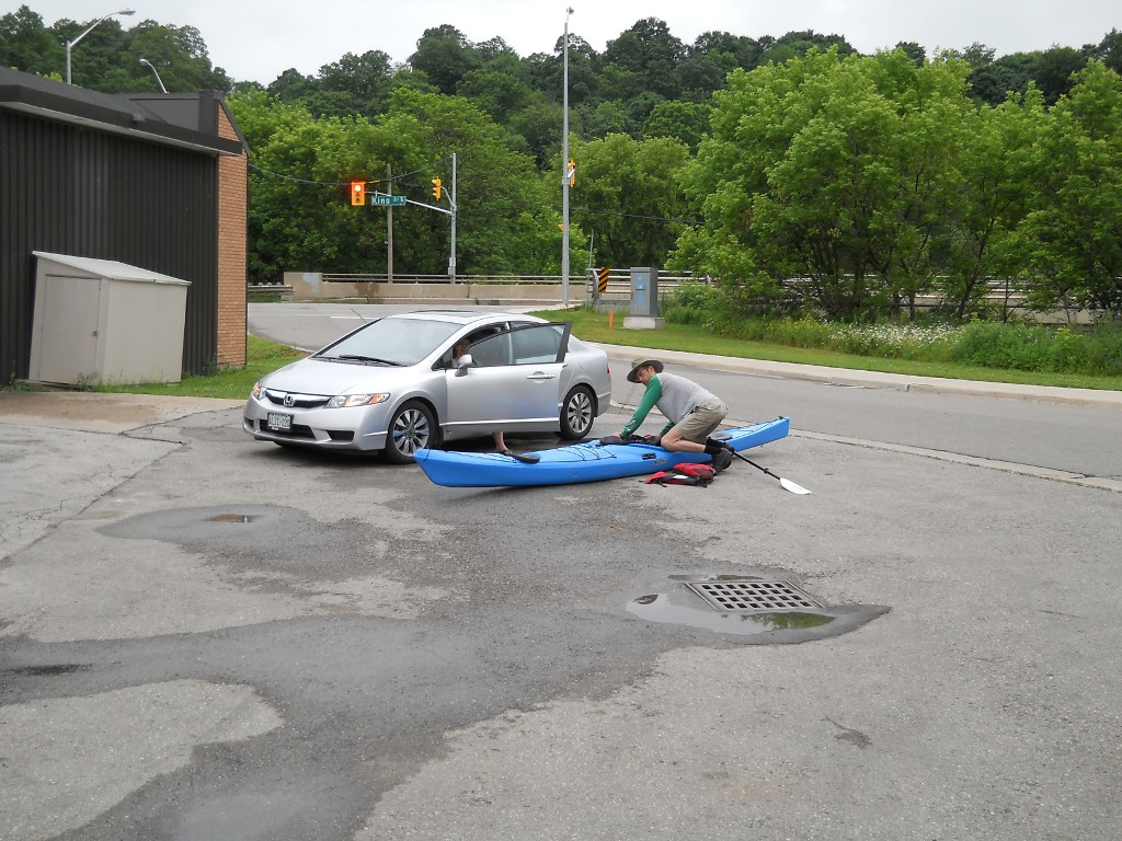
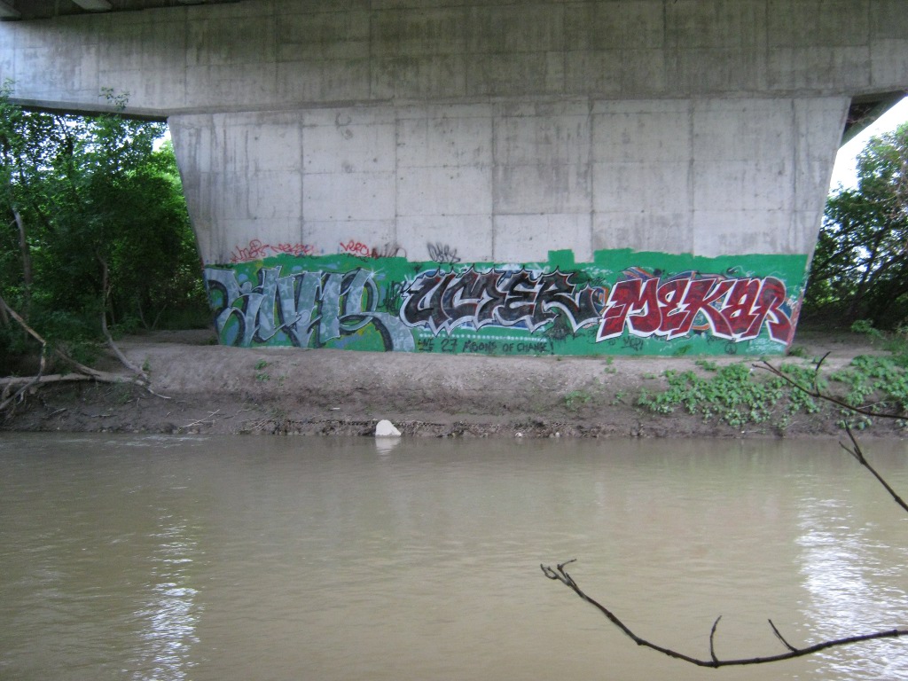
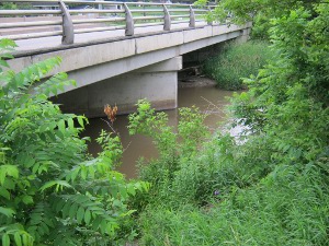
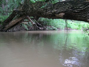
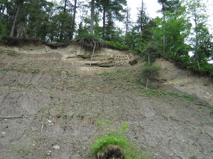
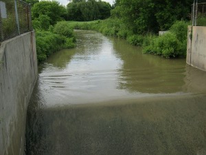
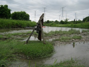
07:30 In the morning the two
of us and my girlfriend took our cars with the kayaks to our
starting point in Bolton - where the Humber River flows under King
Street. It wasn't a great landing place (see the photo below, that's
what we had to stomp through), but it seemed like we'd manage, just
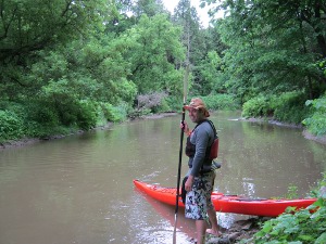
near the bridge on the south-west corner. We unloaded and packed our
stuff into the kayaks, turns out they have quite a bit of storage
room, which can easily store all kinds of camping gear as long as
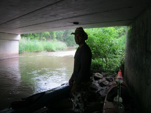
it's wrapped water-proof. 30 minutes later Bill took his car to be
parked at the relatives (my girlfriend would drive my car back
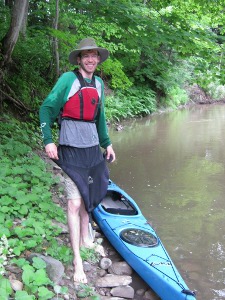
home). That's Bill on the left with his orange kayak and me on the
right with the blue one, struggling to get the skirt onto the kayak
for the first time.
I walked around snooping. There's some kind of trail going south
next to the river there and I walked down it for a couple of
minutes, but I didn't see any better places to take the kayaks down
than next to the bridge, so I didn't go much further. When I got
back - it started raining. It was likely to happen so I wasn't
surprised, but I was hoping we'd be well on our way before it
starts. Meh - whatever. It would rain on-and-off all day, but that
was only a minor nuisance since the air was quite warm.
We also didn't know what to do with the skirts - so we pulled them
over the kayaks and got into them after we lowered them into the
water. Later Bill found it's much easier to simply never take off
the skirt, and putting it around the kayak's rim from the back to
the front is actually pretty easy when you're sitting in it.
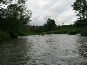
08:20 The kayaks were in the
river, and we stepped into them for the first time. I found it
pretty easy to balance, it seemed it would be much harder. Turning
took some getting used to (it's nothing like a canoe) but I got the
hang of it pretty quick too.
08:50 Soon after we started
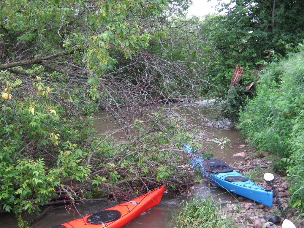
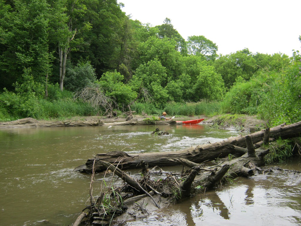
we hit our first obstruction: a fallen tree with whatever junk got
caught in it. This required us getting out and pulling the kayaks
over.


There would be quite a few such little portages required later, but
none that would make us worried we couldn't do it. Another first
lesson though - take your shoes off right away, and leave them off
unless you're taking a lunch break. If you try to wear them while
getting in and out of wet dirty slippery rocks - they will get
soaked very quickly.

By now the rain has stopped, so this wasn't as miserable a first
mini-portage as it could have been. Actually, speaking of portages,
don't plan any ones longer than a few meters - a kayak isn't made
for them so I'd leave such exertions until you have some experience.
Even with two people taking a kayak it's pretty difficult.
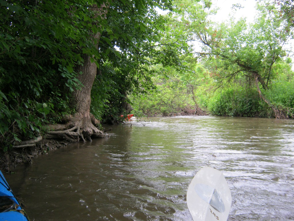
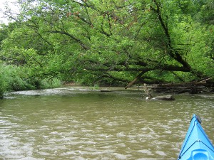
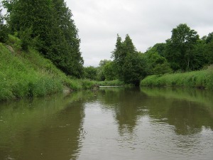
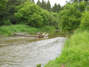
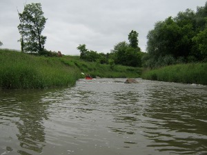
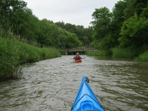
09:20 Smoke break,
Albion-Vaughan intersection will be coming soon. These photos are
from random places in the following stretch:
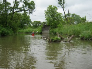
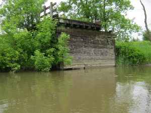

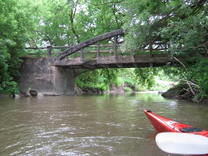
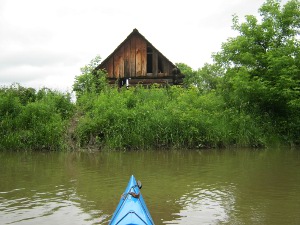
I don't know what that half a bridge was. There wasn't anything on
the other side, but it looked like more than a deck. Maybe it was a
really fancy fishing deck at some point.
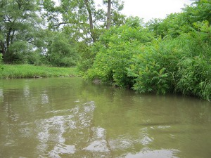
You may be tempted to exclaim that the water looks filthy. It is :)
I definitely wouldn't want to swim in it, but I wouldn't go so far
as some who suggest you can't even touch it. It smells a little
unpleasant too in places, but I'm not sure of what. Not sewage, more
like used motor oil.
10:30 Took a break, had some
snacks. On Google Maps on the phone we're showing up somewhere in
the middle of the green, NE of Cold Creek and Kirby. My thermos with
hot tea made me happy warming me up a little. Put some bug spray on,
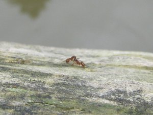
lots of those flying around. And not just flying but crawling too.
Red ants all over the place - these are nasty, they climb all over
you and before you know it you're being bitten everywhere at once.
They're so mean they eat each other too, I've observed a couple of
them fighting to the death on a log. What's worse is that you don't
see them right away if you're not paying attention and by the time
you realize what's going on you're being bitten all over the place.
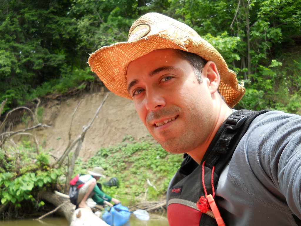
Man, I look ridiculous wearing the skirt and for some reason the
life vest though the water is knee deep :) Notice also that my shirt
is wet and Bill's isn't, I have to get one of those too.
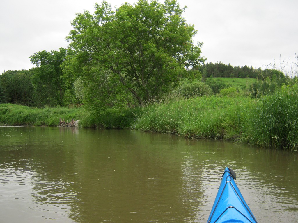
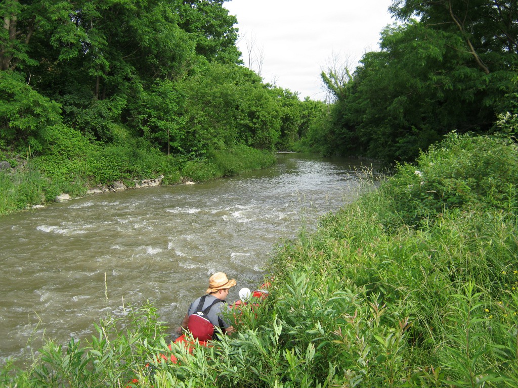
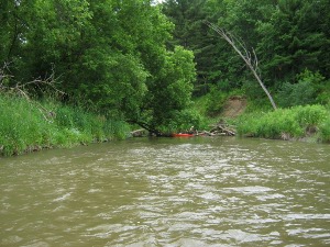
15 minutes later we were off.
11:35 We're still in the
green thing, as if not moving at all. GPS on the phone claims to be
working and I'm reminded of the very long very winding Algonquin
rivers. Maybe we'll make it to Kleinburg soon.
Yep, you get stuck sometimes!
This bridge is clearly abandoned, and has lots of grass growing in
it, though the structure seems to still be intact. The strange thing
is later on we saw another bridge just like this one, in roughly the
same condition, but instead of grass it had cars going over it. I
wish I knew where this one was so I could find out whether it was
abandoned because of the bridge quality or other reasons:
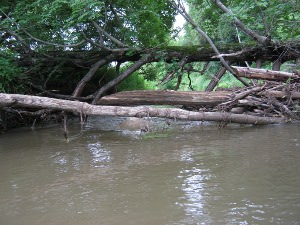
12:30 and 12:35 Sometimes
it's really tough. And though the first one looks worse, it's
actually the second. You can sort of see a little bit of room under
the branches of the first, no such luck later, I think I had to get
out into the dirt and pull the kayak:
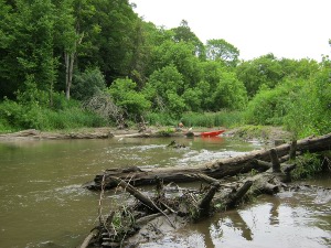
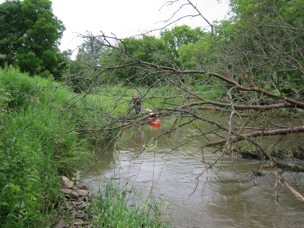
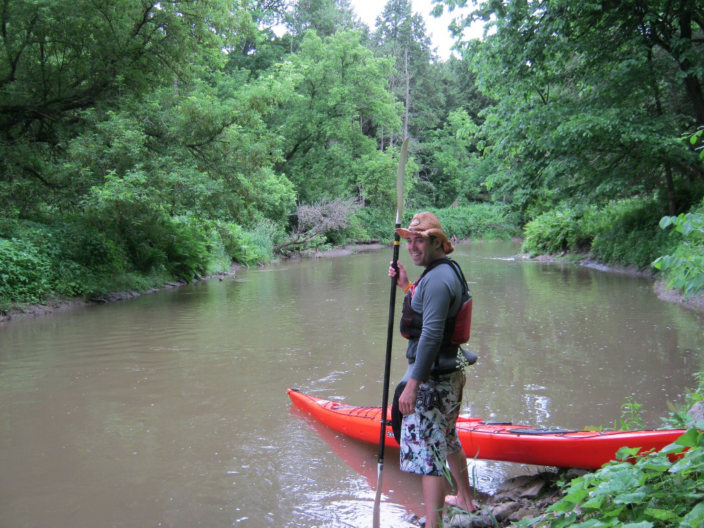
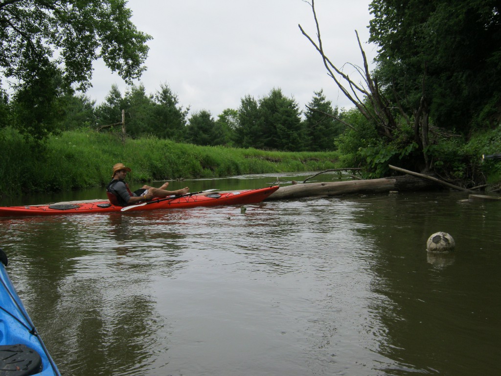
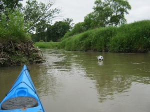
We relaxed a little and played a little bit of paddle soccer, we
found at least 3 soccer balls in the river, none of them in good
enough condition to keep. That's me writing down these notes on
sticky pads :) and Bill showing off his camera skills:

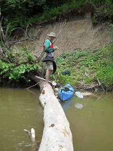

13:25 to 14:00 Lunch on the
side of a river, next to a farm. Had a bit of everything including
some soup made on the portable stove. The farmer came out and was
quite nice. Looking at the map it seems we still haven't moved at
all.

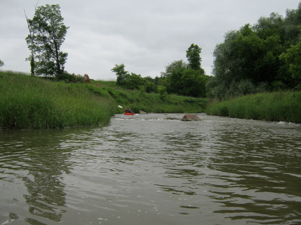
14:52 There were a bunch of
rapids after the farm, but I was too busy having fun to make photos,
this is the only one I have, at the end of one stretch:
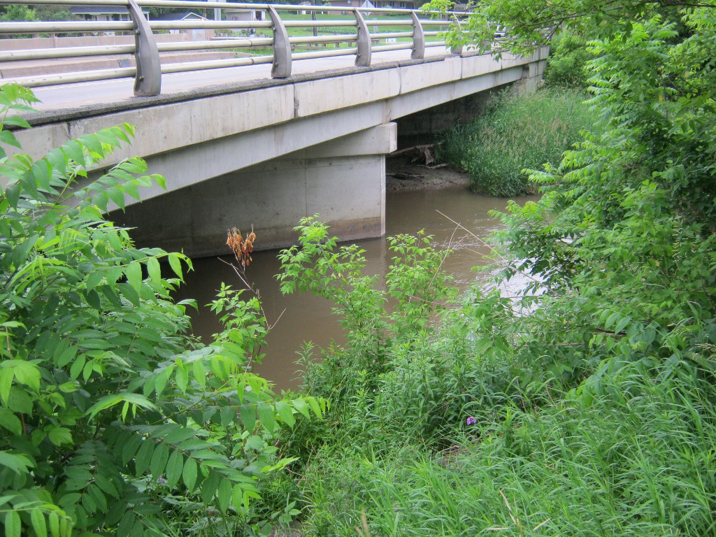
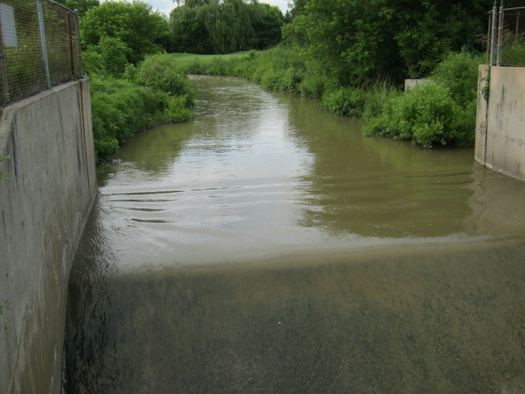
15:00 The first big bridge.
Don't know what it was, I had some suspicions but forgot by now when
writing this.
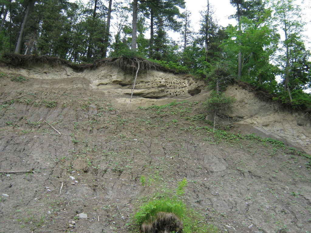
15:20 Birds live in those
holes:
15:30 Saw a sign for Major
Mac West, yey, we're actually getting somewhere!
And here are some things I mentioned earlier: the
being-used-but-not-in-much-better-condition version of the bridge
(p.s. another Andrew emailed me to say this one was the Humber
Bridge Trail), a better but not good enough to keep soccer ball, and
the fighting ants:
16:45 We're south of
Rutherford.
17:17 Going next to a golf
course there were several of these somethings. They seemed to be
large pipes under the water but maybe they were some sort of
mini-dams for watering the course, I'm not sure. Though they're only
a half a meter deep - going over them is pretty exciting:
17:20 We were prepared after
being warned by a golfer that a larger dam may be coming, so when I
heard a rush of water and felt the current speed up and saw not the
bottom of the drop - I told Bill what I expect and went forward (on
the kayak of course) to investigate. That wasn't the brightest idea.
The drop was way too scary by the sounds of it to try blindly, and
the current so strong that I could not even turn the kayak back.
Actually I may have done it once but there was no way I could paddle
against the current.
So I had to get out where you can see the little concrete block in
the bushes and it was a pain to pull the kayak through that jungle.
Bill was smarter and got out earlier on the other side, and by the
time I pulled my kayak out he was already on the other side of the
dam, I forgot to ask him how he managed to carry it alone.
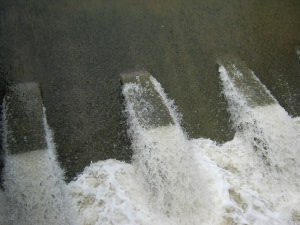
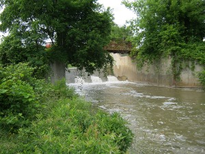
It's actually conceivable to go over this dam in a kayak - you just
have to make sure to go in between the teeth and if you do - there
shouldn't be much trouble. But if you hit one of them and tilt and
hit your head on one of the others - there better be someone down
there waiting to fish you out. We didn't have such a fancy
arrangement so walking around was quite alright.
On the other side the current was also very strong, so once you were
off there was no turning back:

Even so somehow I managed to get stuck there, with the tip of my
kayak in between two trees. It was quite difficult to get myself out
because of the current. Actually by now I was getting sloppy. Later
on I almost lost my hat (thankfully it had a string holding it), and
then I lost my paddle, and floated helplessly while waiting for Bill
to decripple me.
17:40 We're both over the
dam and on our way. From here on the Humber is quite wide and
sufficiently deep that you don't get stuck unless you're trying to,
like me. It's not as fun, but I'm not sure we could have handled
much more pulling ourselves over, under, and around things.
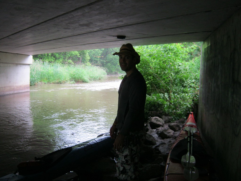
18:15 Woodbridge St.
This chair is on an island (can kayak around it on both sides), and
I'm not sure what it's for, it was completely weird:
18:45 Highway 407
19:00 Steeles. We decided
this was all we could do that day. Completely exhausted after 11
hours of tough paddling, clearly not going to make it much farther
before darkness, but happy with a pretty decent achievement we
called it a day. This is the bridge under Steeles:
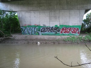
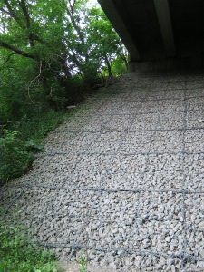
Those rocks held together by big chicken wire and though it was a
high climb, it seemed like the easiest way to get the kayaks up. We
did have the option of carrying them around, there's a path there,
but I'm not sure that would have been easier, since the distance
would have been much longer.
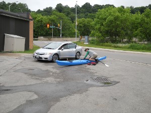
Up there on the bridge is a parking lane (I'm not sure what its real
purpose was but it's not for driving), and it was a perfect place to
load the kayaks. We asked my girlfirend to come get us, drove to
Bolton to pick up Bill's car, came back and loaded the kayaks (noone
would have found them - they were well out of view and noone walks
there anyway), went to my place, and drove them to MEC in Toronto in
the morning.
I'm hoping that later this year we'll finish the trip and go all the
way to Lake Ontario, maybe!
If you have questions for me, please use this
form.
Other trips of mine.
Cheers!